
Tees Bay Dune System Management Plan
Tees Bay Sand Dunes
Situated at the mouth of the Tees Estuary, the Tees Bay sand dunes are one of the largest dune systems along the northeast coast of England, running from Seaton Carew to Marske-by-the-Sea. The Tees Bay dunes are situated in a complex area and are directly backed industry and residential properties. Despite this, the dunes are ecologically valuable, supporting internationally important breeding bird populations and nationally rare invertebrate assemblages, as examples.
Most of the priority sand dune habitat is contained within the Teesmouth and Cleveland Coast Site of Special Scientific Interest (SSSI). As a designed feature of the SSSI, the condition of the duneland habitat was recently assessed to be in unfavourable (declining) condition.
As such, ABEC were commissioned, on behalf of Natural England, to produce a 30-year management plan for the Tees Bay dune system, with the main aim of improving the condition of duneland habitat within that period.
Site visit
In February 2026, Ben Long (Assistant Ecologist) and Anthony Swandale (Associate Ecological Advisor) travelled up to Middlesborough and the surrounding area to meet with local stakeholders and find out more about the issues facing the dune system. It was an opportunity to hear about local visions for the site.
Over the three-day visit we met with Natural England and local stakeholders, including council authorities. It was an insightful three-days and a great opportunity to explore the dunes.
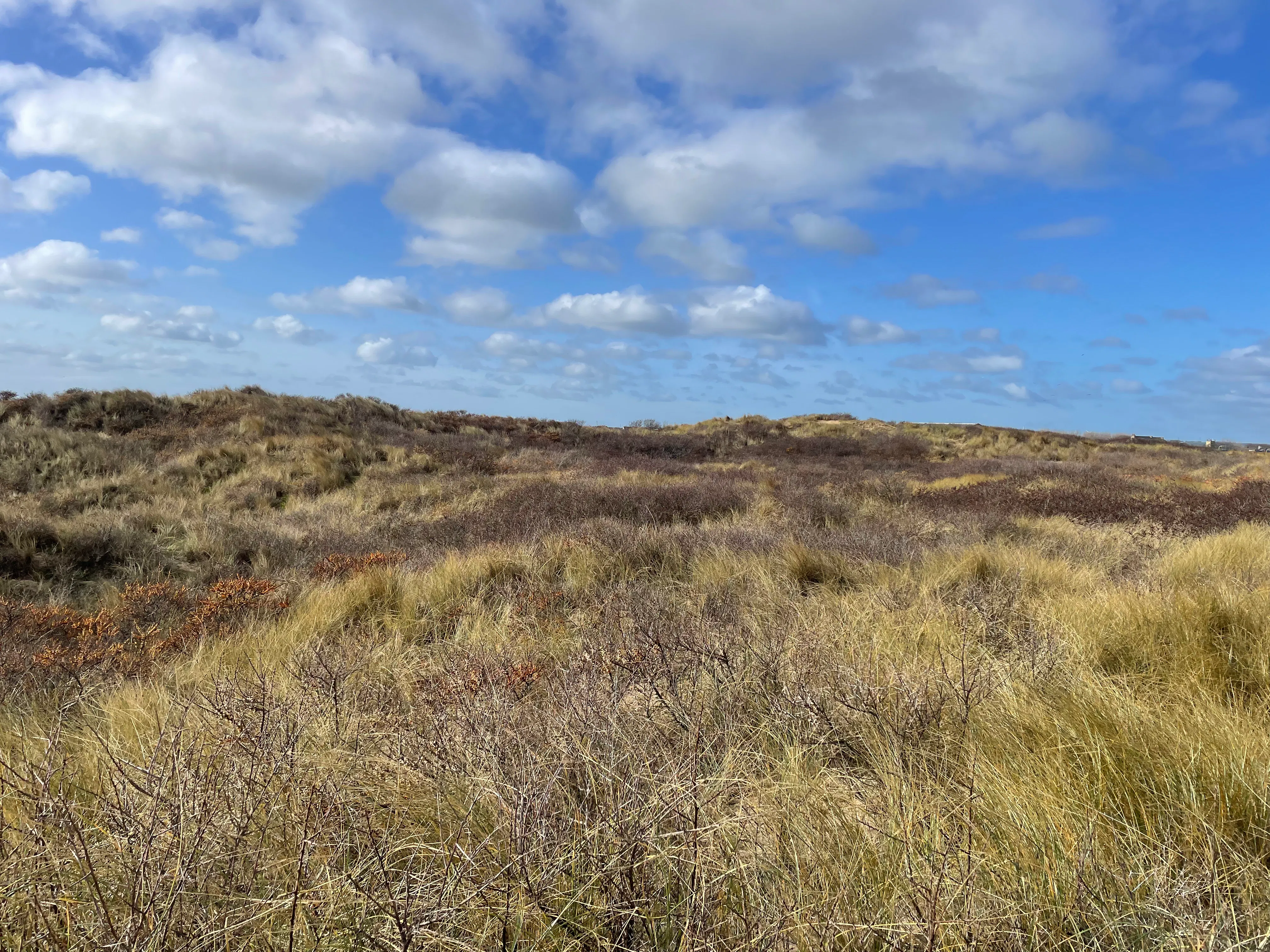
Semi-fixed dune overrun with introduced sea buckthorn (Hippophae rhamnoides) vegetation, its removal is a one of the focuses of management plan.
Information gathering
Upon return from Teesmouth, research began! The first stage was gathering as much information as possible on the site, its ecology, history, and protections. As part of this process we corresponded with local experts, including invertebrate and bryophyte specialists, to learn more about the species present and their habitat requirements.
This independent research informed the site information section of the report. Numerous sources were used including biological records, previous survey data, local field guides, grey literature, as well as information we had gained from the site visit.
Mapping
We conducted an investigation into accretion and erosion across the dune system. For this we used available aerial and LiDAR data from the Coastal Monitoring Programme. Members of our GIS team, alongside our Coastal and Marine Ecologists, mapped the seaward-most limit of established dune vegetation (the ‘dune toe’) over the available time period in QGIS. They also mapped out the site’s topography over the time period to identify changes.
From this, we could investigate Net Shoreline Movement, to determine to classify whether discrete sections of the dunes were accreting, eroding or were stable over the time period and across the whole site.
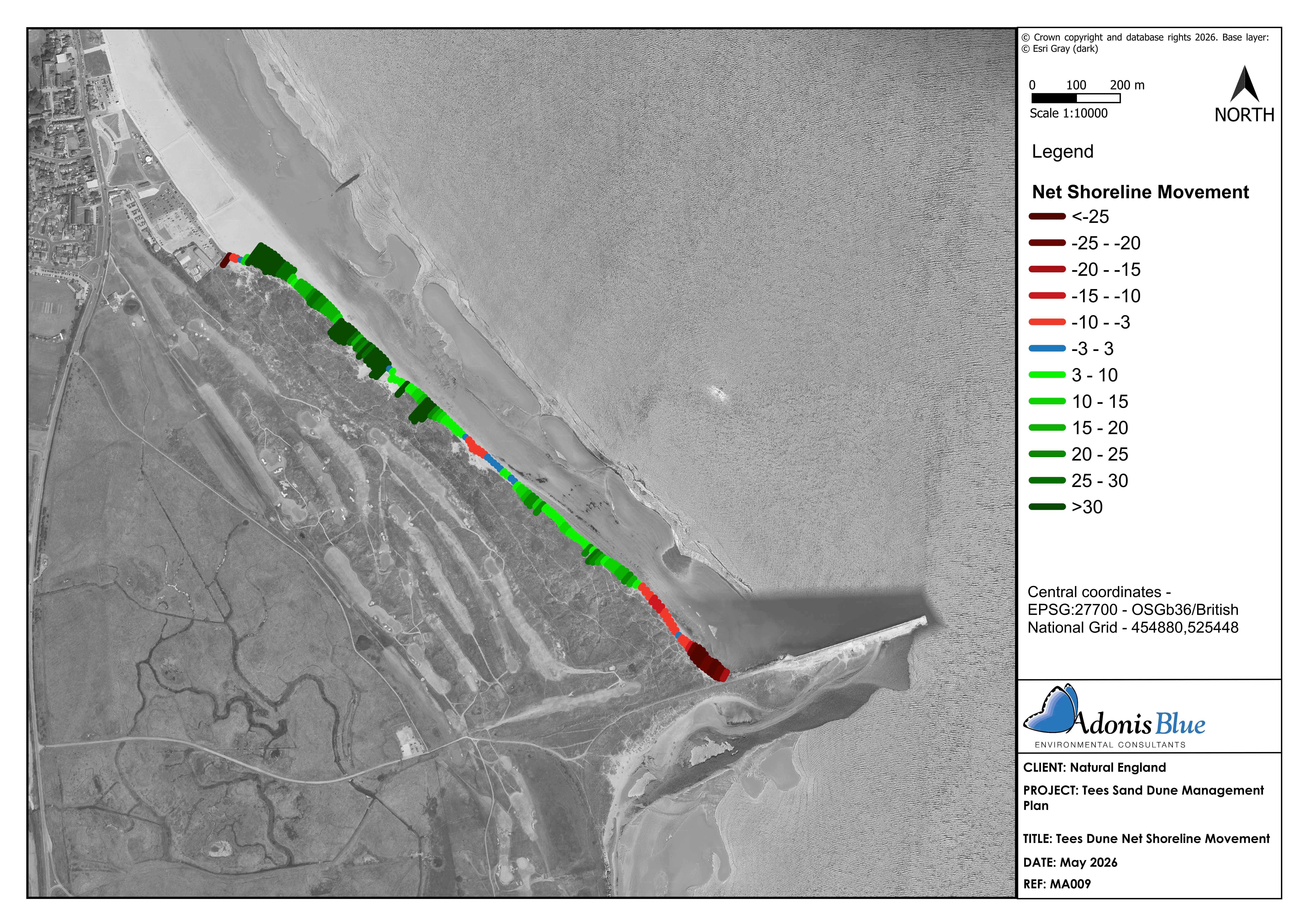
Net shoreline movement mapping colour-coded to highlight areas of accretion (green) and erosion (red).
Management advice
In discussion with the team at NE, we decided upon management plan objectives. For each issue identified on site, our Coastal and Marine Ecologists provided innovative and feasible options to achieve favourable habitat, using the team’s previous experience of managing duneland habitat as was as the most up-to-date advice and research. Management options were detailed within a 30-year Habitat Management and Monitoring Plan (HMMP).
Our team also engaged local stakeholders in this process, asking them for feedback on suggested management options to ensure the HMMP was agreeable and therefore actionable.
Additional outputs
To aid the NE team yet further, within the HMMP, a costed scheme of works was provided detailing the costs associated with each of the management actions. Our Nature-Based Solutions experts also provided an analysis on the ecological, social and economic benefits of healthy, functioning dune systems.
ABEC are pleased to be part of nature recovery around the Tees and we look forward to seeing the Tees Bay dunes flourish in the future.
![]()
Crawley Green Infrastructure & Biodiversity Net Gain Sites
The Client Crawley Borough Council (CBC) commissioned a strategic study to identify and prioritise opportunities for Green Infrastructure (GI), Biodiversity Net Gain (BNG) and nature recovery across the borough. The…Green Infrastructure AssessmentsGreen FinanceLPABNGCrawley


